
Backpacking in Wrangell-St. Elias: A Trip Report
The Revel crew guided a small-group backpacking trip on the Lost Creek/Trail Creek Loop in the summer of 2024. We thought we’d share some lessons learned and highlights from the trip.
Wrangell-St. Elias National Park & Preserve is huge. At over 13 million acres, it’s the largest National Park in the United States, “the same size as Yellowstone National Park, Yosemite National Park, and Switzerland combined,” according to the Park Service website.
Most folks visiting the park access it from McCarthy/Kennecott, an area with a rich mining history, historic builds, and glacier access. Our group traveled along the northern boundary of the park, accessing our backpacking route via Nabesna Road.
Nabesna Road has limited amenities (similar to McCarthy Road), but a couple of highlights include the Slana Ranger Station and the Wrangell Mountains Wilderness Lodge. Do yourself a favor and incorporate both into your visit! We started and ended our trip at the lodge, and would highly recommend this strategy. A hot meal and a comfy bed after a long backpacking trip sure beat a long car ride with a bunch of other sweaty backpackers.
Alaska Native cultures in the region: “Indigenous cultural sites are distributed throughout the entire park with the oldest known site, Nataeł Na’ (named for the traditional Ahtna place name for Tanada Creek), dating to approximately 13,000 years ago,” according to the National Park Service.
Athna people still call this area home today, in addition to Upper Tanana, Eyak and Tlingit peoples. The park visitor center in Copper Center has some informative exhibits about Alaska Native peoples from the region.
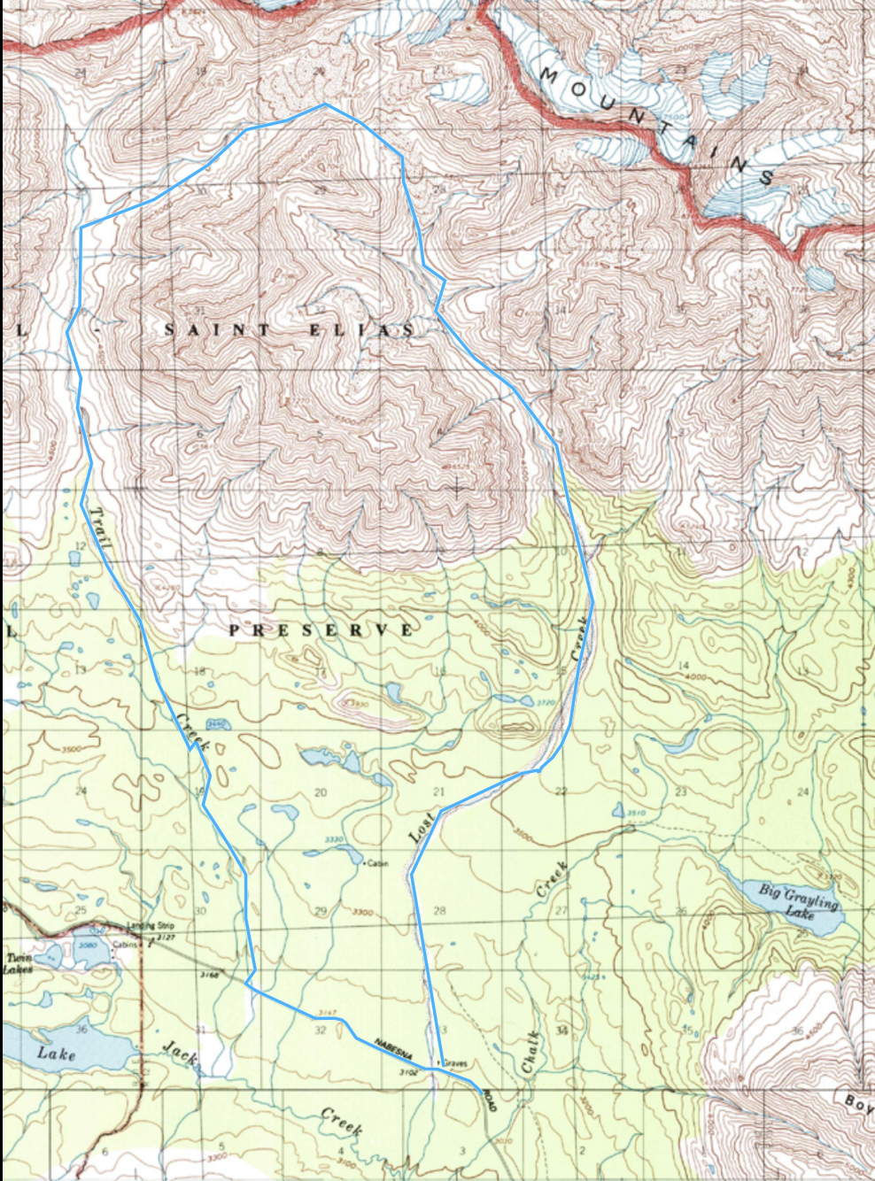
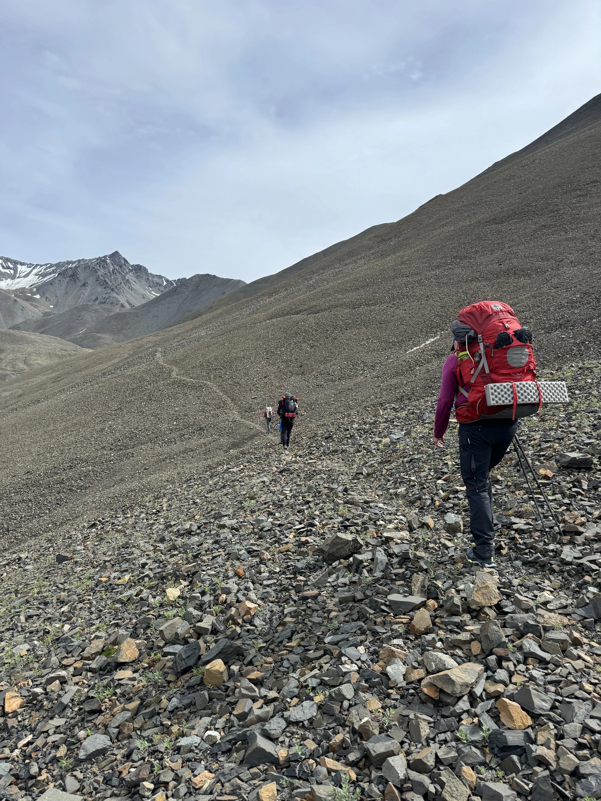
The Route:
The Lost Creek/Trail Creek Loop is a route, not a trail. Backpackers follow creek drainages on the east and west of a 6,000’ pass. The Park Service describes the route as strenuous and notes it requires significant backcountry trip planning. NPS notes the route is 22.5 miles in total including 1.5 miles on the road.
Our group logged about 24 miles in total and had a pickup upon exiting the Lost Creek drainage (so we didn’t have to hike the 1.5 miles on the road). A game trail that led us to a cliff added some miles to the adventure, along with meandering creek crossings, and impromptu explorations.
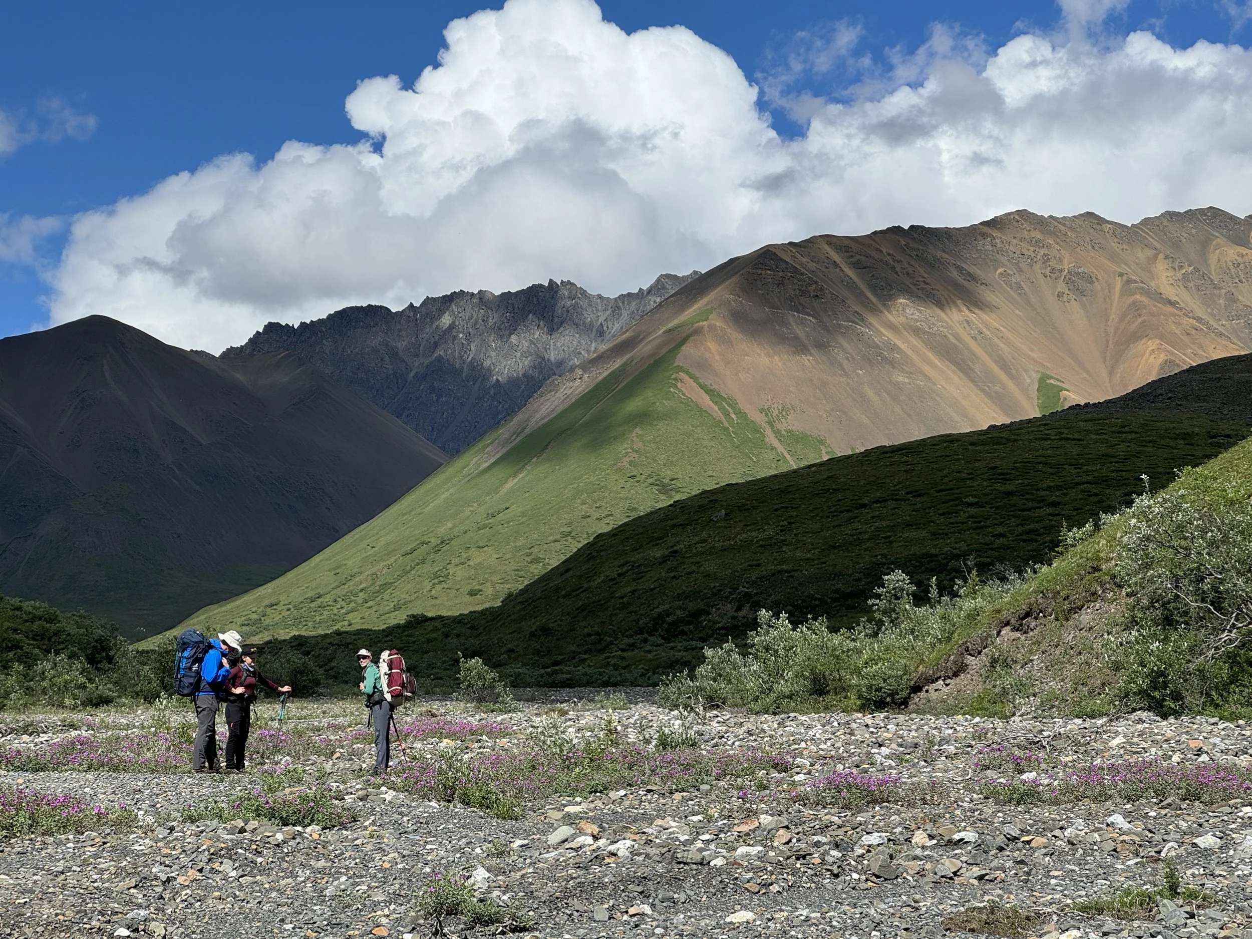
The Highlights:
Dall Sheep - we counted close to 30 in total.
Colorful landscapes - the difference in color and texture of the landscape on either side of the pass was dramatic and unexpected.
Wildflowers - because their season is so fleeting in Alaska, it seems appropriate to savor them on backcountry adventures.
What we’d do differently next time:
We’d spoken with a couple of folks who had recent trail beta and advised us to travel the ‘inner loop’ on the route - stick to the eastern part of Trail Creek and the western part of Lost Creek.
This was mostly ok except for one particularly challenging part of the Lost Creek drainage. During the final day of our trip, we were in and out of heavy fog, and visibility more than 50’-100’ in front of us was non-existent. There could’ve easily been another way to travel, but that’s for the fog and other backpackers to know.
The NPS map easily identifies a “narrow canyon” section along Lost Creek where hikers need to climb a few hundred feet in elevation to avoid the canyon. We traveled on the western side of the canyon and found ourselves following a game-trail-probably-turned-human-trail along very steep terrain with moderately uncomfortable exposure. In the fog, it was difficult to tell if an alternate, less exposed route existed, so we trudged ahead.
The group managed this section well enough, but we wondered if traveling on the eastern side of the drainage, or higher on the western side would’ve been an easier route.
For July, we found the creek crossings for both Lost and Trail to be uneventful; however, it was easy to imagine they could be problematic with heavy rain.
Day 1 Highlights: Nabesna Road, Trail Creek, Wrangell-St. Elias National Park


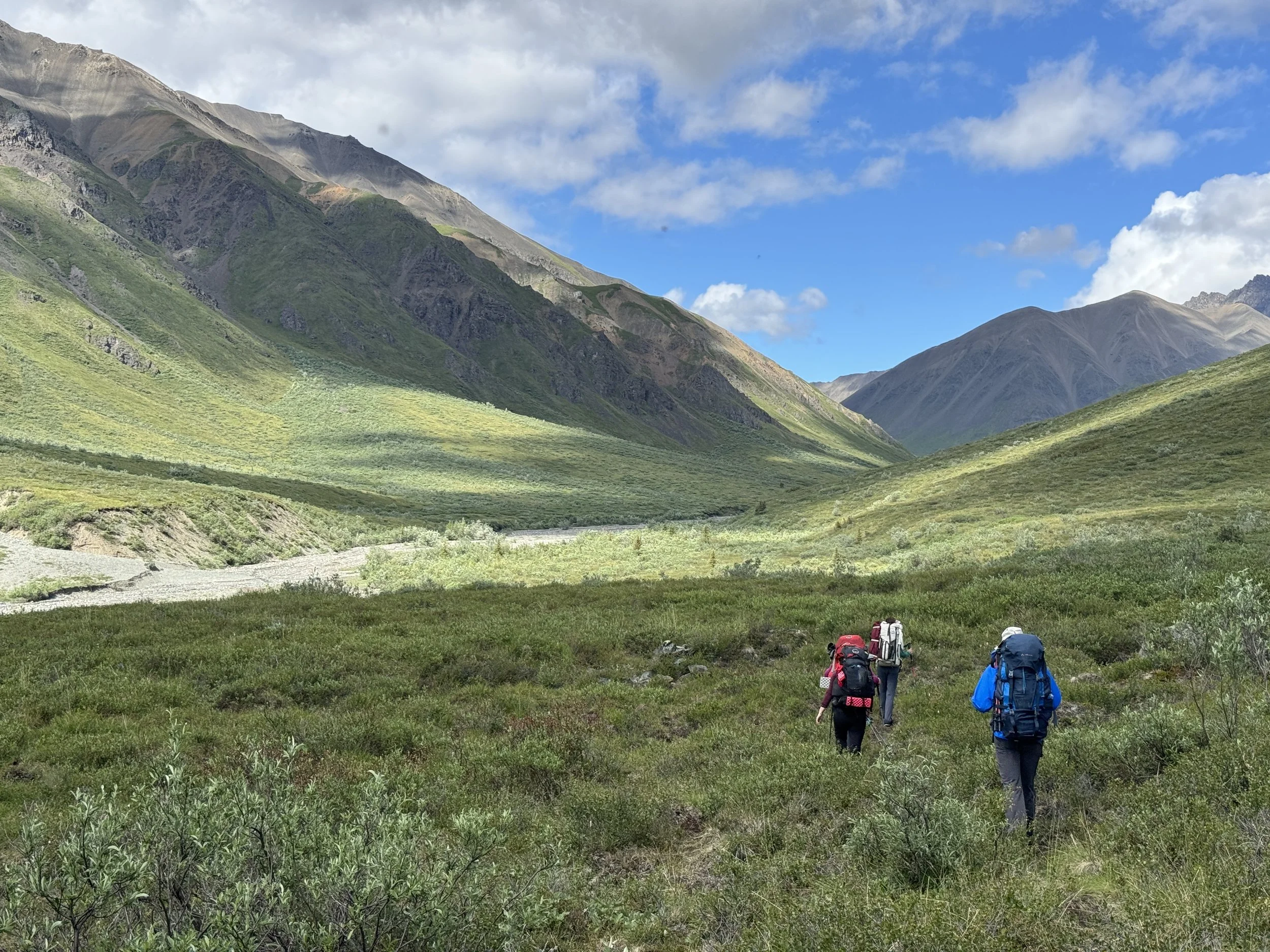

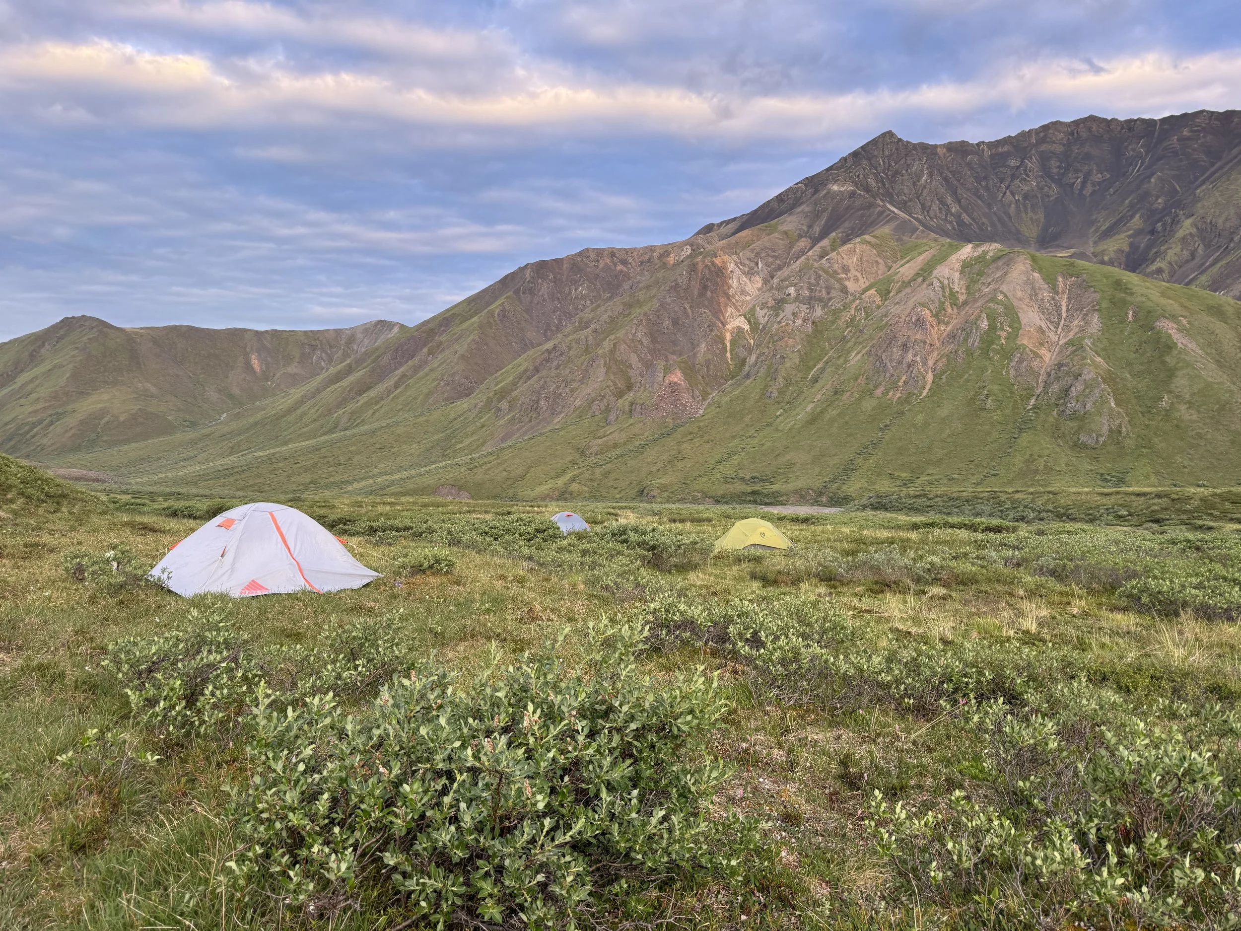
Day 2 Highlights: Trail Creek drainage to Lost Creek drainage, Wrangell-St. Elias National Park


Day 3 Highlights: Lost Creek to Nabesna Road, Wrangell-St. Elias National Park


